
Watuppa/Wampanoag Heritage Trail
Overview:
 Since 1995, Green Futures has been actively planning and implementing this historically significant long-range walking/hiking trail. The area between the cities of Fall River and New Bedford, Massachusetts contains the last large block of open space land and is invaluable in saving some part of the original environment of this section of New England. This land possesses unique and remarkably varied views of what the area must have looked like during the colonial settlement period.
 The Watuppa/Wampanoag Heritage Trail will serve as a catalyst in uniting various outdoor user groups, environmental organizations, and other enthusiasts in preserving representative local habitats. From coastal salt marsh, through freshwater wetlands, to oak-pine uplands, the trail will pass through natural areas large enough to be important to species preservation and biological diversity.
The trail passes through mostly public open space land from near the Freetown State Forest and terminates at the Acushnet Cedar Swamp State Reservation. We are working with the Greater Fall River Land Conservancy, Buzzards Bay Coalition, other land trusts and private landowners to try to maintain a green corridor for those portions of the trail that pass through other than state or municipal open space properties.
Objectives:
Our objectives for continually striving to make this trail complete and permanent are varied:
- We wish to make residents and visitors aware of the substantial human history, natural resources and aesthetic qualities of the remaining forested land in this part of southeastern Massachusetts, part of the Taunton River and Buzzard's Bay Watersheds and public open space lands within the Freetown State Forest and the Acushnet Cedar Swamp State Reservation.
- We would like to increase the public's understanding of watersheds and the fact that what occurs on a watershed is reflected in the waters that flow from that watershed.
- Youth involvement: It would be great to see area youth get involved in the positive activities of trail and environmental management and the creation, research and maintenance of the trails.
- Forest users would be given the only long-range trail possible in our urbanizing area; they would become responsive toward the protection of the forest environment and wise stewards if its resources.
- By making the forest a pleasant natural area where families can rejoice, recount, reenact and recreate in the aesthetic potential of the forest, community environmental awareness will be heightened.
Description:
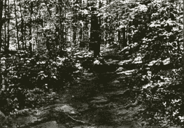
 This unique trail follows the native Indian pathways these first Americans traversed in moving from the shellfish rich tidal estuaries in winter, to the summering grounds in the uplands. The trail corridor area is also replete with old foundations, ruins and artifacts from the colonial era. Contemporary hikers will be amazed to find they can walk from Fall River to New Bedford and not only pass through varied natural habitats, but through history as well.
Most of the trail passes through the Massachusetts State Forest land and other protected open space properties. This land was acquired by the Commonwealth when early residents abandoned their rocky New England farms and headed into the then booming cotton mill cities of New Bedford, Fall River and Taunton seeking a more secure way of life.
Within or close to the corridor of the proposed trail are early Wampanoag Indian archeological sites as well as the presently active Assonet Band Wampanoag Reservation. Also, one can see colonial era mill ruins, mill stones and waterworks; a former granite quarry from which were constructed many of the textile mills and public buildings in this part of Massachusetts; stone boundary walls and animal pounds; cellar holes with old plantings of lilac and day lilies around them; an extensive colony of Hartford (climbing) fern (Lygodium palmatum); a pathway that was once the main road from the new seaport of New Bedford to the County Seat at Taunton; and the Depression Era Civilian Conservation Corps works.
Names of natural features and old settlements, along the proposed trail corridor, evoke an earlier simpler time when folks lived close to the land. Peace Haven, Mother's Brook, Rattlesnake Brook, Dr. Durfee's Mill Pond, Bell Rock, Boiling Spring, Fighting Rocks, Break Neck Hill , Betty's Springs, King Philip Brook are a few examples.
 The trail is situated on @60% state contolled land, 30% privately owned forested land, and about 10% along town roads. We are presently seeking permission for permanent trail construction from the owners of these privately owned parcels.With much appreciation,we are allowed temporary use passes for our annual Big Walk.
The trail will be approximately 25 miles long and will be the only long range hiking trail in Bristol County, a unique item in this heavily urbanized section of Massachusetts.